Area
All investigations carried out in the context of the Kola Ecogeochemistry
Project are located within the area comprising all major landmass
found:
North of the Arctic Circle in Finland, or of the Murmansk-Karelia
County border in Russia
South of the Barents Sea
East of 24 degrees E of longitude
West of 35.5 degrees E of longitude
The map below shows the study area for the Kola Ecogeochemistry
Project. Different sub-projects focus on
different parts
of the above area. The largest frame on the map covers an area
of 188,000 km2.
LOCATION MAP
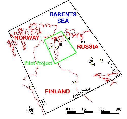
(Map: P. de Caritat)
Map showing the location of the pilot project (green frame), catchment
study (yellow dots) and regional geochemical mapping (black frame)
areas from the Kola Ecogeochemistry Project. Towns of Kirkenes
(K), Nikel (N), Monchegorsk (M), Murmansk (Mu) and Zapoljarniy
(Z) are also identified.